As my
Literary Flits bookreview of Walk! Dartmoor published itself yesterday, Dave and I were just setting out on the last of its suggested routes, Number 40: Avon Dam and Red Lake Quarry. We began by parking at Shipley Bridge where there is a small car park (£1 donation towards upkeep) just south of the Avon Reservoir. We got lucky with a space as it was already pretty full and indeed by the time we returned cars were parked out on the road and verges as well.
The route is very easy to begin with. It is a narrow tarmac road which goes up to the striking sight of Avon Dam. We passed lots of people on this first section including families with young children because, while the scenery of green trees and babbling brook is beautiful, it is also perfectly surfaced for pushchairs! I was disappointed to also see evidence of irresponsible dog owners. Two had bagged their dog's poo and then left the bags lying around for 'someone else' to clear away and, despite several signs requsting dogs be kept on leads during lambing and nesting season, two-thirds of the dogs I saw were running loose.

A track forks uphill before the dam and immediately becomes less well-used as it is not surfaced. It leads alongside the reservoir and allowed us the first of numerous gorgeous views across the valley. The dam itself is rather a shock! In the midst of natural greenery there is suddenly an enormous wall. Built in the 1950s, its purpose is to provide drinking water to towns situated in the lowlands. We wondered if it is used to create hydroelectric power too, but apparently not.
We continued alongside the reservoir until it narrowed back to a stream and the ground became very boggy. Faced with a stone wall and gates, we knew we had to go straight ahead, but couldn't get to the gate for the bog. It later turned out that had we kept tight to the stream bank on our left we could have kept dry and hopped over a stile cunningly disguised in a fence section. Instead we aimed right where a brook tumbles down the hill, eventually managing to ford this a hundred yards or so uphill.
 |
| Clapper bridge |
Back on the right route again, our next obstacle was that stream. It does have a ford located just as it bends to the right, however there must have been significant rain on Dartmoor as it was fast flowing so we took the clapper bridge option instead. This bridge is about 300 yards upstream from the ford - the path leads directly to it.
So brook and stream forded and boots still pretty much dry, we sallied forth up an old mining track - a gert. I could see the silhouettes of Petre's cross and another stone marker up on the hill directly ahead of us although our path curved to the right and then back around to circumvent the steep end of a small valley. Unfortunately just as we got near the crest this happened:
It's quite unnerving to be walking on a clear day one minute and to find yourself inside a cloud the next! Our route had a short out-and-back detour to Red Lake Quarry which we had already decided not to take, however right at this point we were struggling to see anything more than about ten yards away! Fortunately, with a combination of Ordnance Survey map, guide book and compass we located Petre's Cross.
 |
| Petre's Cross |
Unfortunately, on continuing we then found ourselves approaching what appeared to be a huge stone submarine, looming out of the mist! This is actually the Eastern White Barrow or Whittabarrow, a Bronze Age cairn which was enlarged at a later date into the landmark it is today. We didn't know that at the time of course. I googled it later. At the time we just knew that our guide book didn't mention any submarines, stone or otherwise, so we were going the wrong way. Oops!
 |
| Eastern White Barrow |
We weren't far off where we should have been. We had set out from Petre's Cross on too easterly a path, so now struck off south to find the disused tramway that we should have been following. In hindsight this was pointless as, even if we had crossed the tramway (and we might have done) it looks remarkably similar to any other track across Dartmoor so we were unlikely to have recognised its true history. We ended up on a compromise route that progressed, I think, in various degrees of parallel-ness to our guide book's suggestions.
 |
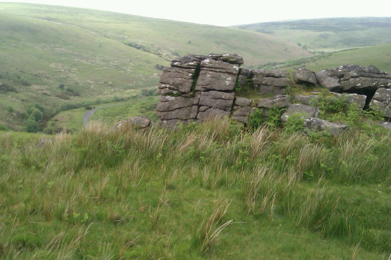
| Black Tor |
The mist began to clear as we crossed Brent Moor and we got to appreciate the dramatic rocks of Black Tor close up and were relieved to spot the tarmac track to Avon Dam way below - down a steep ridge and across the river! Fortunately descending the Shipley Bridge side of Black Tor was relatively simple and, again, had we been further over we would have been following another disused tramway. Dartmoor is riddled with them!
We were never very lost and Dave was always confident of the direction in which we needed to head, if not the exact don't-they-all-look-similar track we needed to follow. It was easy to imagine though how people could get easily turned around and end up marching out into the middle of the moors, not realising their mistake until too late. The experience was a tad scary for a while!
 |
| Small boyfriend on a big moor |


Well done for using the old compass and map technique. I'm afraid we're growing lazy and tend to rely more and more on handheld GPS.
ReplyDeleteCoincidentally we were saying that if we had a GPS we wouldn't have felt so lost!
DeleteLooks wonderful, love the misty backdrop.
ReplyDeleteDartmoor is stunning!
Delete