Showing posts with label mountains. Show all posts

Monday, 20 November 2017

Hiking the Ruta de los Puntales in the Serra d'Espada

I'm a tad embarrassed to reveal that we did this walk on Thursday and, four days later, I am still hobbling about with complaining calf muscles! In my defence we walked for more than four hours with a climb (and its corresponding descent of course) of 500 metres. This much exercise is not good for my health!

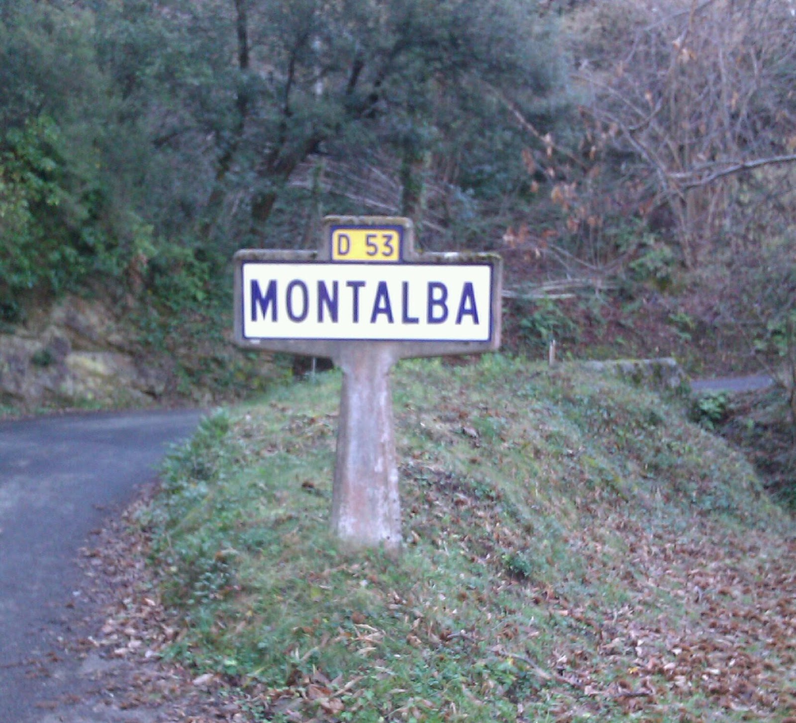
The walk starts from a car park in Vilavella - a town for which the word labyrinthine could have been invented! It's a frustrating maze of narrow one way streets, but we found the right place eventually. The walking route itself is clearly marked all the way. There are new-looking signposts at junctions and regular red and white stripe markers on rocks and trees.

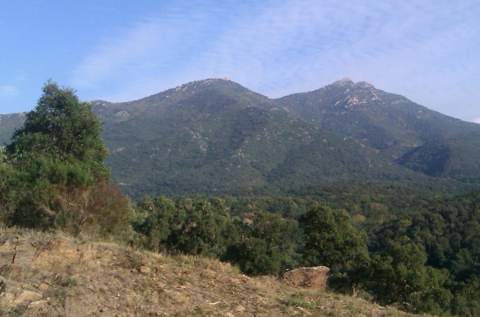
The stunning view photograph at the top of this post was taken at a later point in the walk - from a ruined Civil War machine gun nest. Views early on are no less spectacular though. We began with a reasonably steep uphill climb on tarmac road which became rough track. Starting from cold so to speak it was an effort, but we were rewarded with this:


Aljub dels Caçadors 
After about an hour we discovered the Aljub dels Caçadors. Aljubs are a water storage and irrigation method brought to Spain by the Moors in the middle ages and still used for centuries afterwards. An underground cavern collects runoff and rain water in the wet months. Then buckets can be lowered through a small door to retrieve drinking water for animals. Some Aljub are connected to agricultural irrigation channels with sluice gates to control the water flow. This one now just contains rubble as had the Fonteta d'Oliver, a former spring we had passed about half an hour previously. Fortunately we had taken our own flasks of cold water.

The mapped route along the GR-36 now became a narrow footpath winding through shaded woodland. We saw strawberry trees and nut trees, but unsurprisingly didn't spot any of the promised foxes, badgers or genets! The route has an out-and-back diversion to the Font de Cabres, but we chose instead to turn off the GR-36 for another uphill stretch to the Coll del Bledar. We climbed up away from the trees onto an exposed ridge with more spectacular and almost panoramic views. Our lunch spot was by the slanted rock formation pictured below.


With hindsight, I am glad we didn't add the extra 140 metre climb up to the Pic de la Font de Cabres. Instead we headed east along the ridge past three Civil War structures like the one pictured above. It's tricky terrain up there. I had to concentrate to keep my footing on scree paths in bright daylight with no need to rush. I imagined how much more dangerous the paths would have been in wartime.

The Pic de la Creu de Ferro - yes someone actually carried a large iron cross up onto a mountain ridge  - marked the start of our long descent back to Vilavella. Tree cutting obscured the path for a short distance but we managed not to lose ourselves. This downhill lasted a good hour and I think its mix of scrambling and steep rock steps is probably what did for my legs! We were both proud of ourselves for having accomplished a difficult hike - and very happy to see our car waiting for us!


Je suis un peu gêné pour révéler que nous avons fait cette randonnée jeudi et, quatre jours plus tard, je suis clopinant sur avec les muscles de mollet se plaindre! Pour ma défense, nous avons marché pendant plus de quatre heures avec une montée (et sa descente correspondant bien sûr) de 500 mètres. Cette quantité d'exercice n'est pas bon pour ma santé!

La randonnée commence d'un parking à Vilavella - une ville pour laquelle le mot labyrinthique pourrait avoir été inventé. C'est un labyrinthe frustrant d'étroites rues à sens unique, mais nous avons trouvé que le bon endroit par la suite. Le sentier de randonnée se porte clairement tout le chemin. Il y a des panneaux nouvelles apparences aux embranchements et marquers réguliers rayures rouges et blanches sur les roches et les arbres.

La photographie vue imprenable au sommet de cet poste a été prise à un moment ultérieur à la marcher - d'un nid mitrailleuse ruine la guerre civile. Vues dès le début ne crient pas moins spectaculaire. Nous avons commencé avec un montée assez raide sur une route goudronnée qui est devenue la piste rugueuse. À partir de froid par ainsi dire, c'était un effort, mais nous avons été récompenses avec ceci: (deuxième photographie)

Après environ une heure, nous avons découvert l'Aljub dels Caçadors. Aljubs sont un stockage de l'eau et méthode d'irrigation a apporté à l'Espagne par les Maures au moyen-âge et encores utilisés pendant des siècles par la suite. Une caverne souterraine recueille l'eau ruissellement et de pluie pendant les mois humides. Puis seaux peut être abaissée par une petite porte pour récupérer de l'eau potable pour les animaux. Certains d'Aljub sont reliées aux canaux d'irrigation agricole avec vannes pour contrôler le debit d'eau. Celui-ci maintenant juste contient gravats qu’avait le Fonteta de Oliver, un ancien ressort nous avions passé environ une demi-heure auparavant. Heureusement nous avons pris nos propres facons de l'eau froide.

La route mappée du GR-36 est maintenant devenu un etroit sentier serpentant à travers les bois ombragés. Nous avons vu arbousiers et les arbres de noix, mais sans surprise n'a pas apercevoir les renards, blaireaux ou genets qui avait été promis! L'itinéraire comporte un détournement dehors et en arrière à la Font des Cabres, mais nous ont plutôt choisi a quitter le GR-36 pour un autre tronçon en montée à la Coll del Bledar. Nous avons grimpé loin des arbres sur une crête exposée avec plus des vues spectaculaires et presque panoramiques. Nous avons mangé notre déjeuner a côté de la formation des roches oblique sur la photo quatrième.

Avec le recul, je suis heureux que nous n'ajoutons pas la montée jusqu'au Pic de la Font des Cabres. Au lieu de cela, nous avons marché l'est sur la crête au-delà de trois structures de guerre civile comme celle illustrée au sommet de cet poste. C'est un terrain difficile là-haut. J'ai dû me concentrer pour garder mon pied sur les chemins de l'eboulis en plein jour sans avoir besoin de se dépêcher. J'ai imaginé comment plus beaucoup dangereux que les chemins d'accès auraient été en temps du guerre.

The Pic de la Creu de Ferro - oui, quelqu'un fait une grande croix de fer vers la haut sur la crête de la montagne - a marqué le début de notre longue descente vers Vilavella. Coupe d'arbres obscurci le chemin d'accès sur un courte distance mais nous avons réussi à ne pas nous perdre. Cette descente a duré plus d'une heure et je pense que son mélange de brouillage et étapes rocheuses abruptes est probablement ce qui fait mal à mes jambes. Nous étions tous deux fiers de nous-mêmes pour avoir accompli une randonnée difficile - et très heureux de voir notre voiture nous attend!

Wednesday, 2 March 2016

Walking from Pratdip into the Serra de Llaberia

Pratdip nestled in its valley 
Our friends Chris and Marta, currently still pitched up next door, had raved about their walk from the relatively close village of Pratdip. Isn't that just a fabulous name? It's predominantly an agricultural settlement growing hazelnuts and almonds and dates back to at least 1154 when Pratdip was named in papal bulls of Pope Anastasius IV. As we looked back over Pratdip from the hills above, we could see its ruined castle, but I am getting ahead of myself.

Pratdip is about a twenty-five minute drive from Cambrils,
Civil War memorial 
the latter stages of which are along a winding mountain road that loops around the village. We parked in Carrer de la Creu, the creu (cross) in this case being a memorial to the people lost during the Civil War. For a town of less than seven hundred people now, there were a surprising number of names inscribed around its four sides.

From the cross we could easily spot the first of our distinctive green walking route signs. Pratdip, it seems, is quite the hub for walkers and we were pleased to find ourselves on clearly marked paths almost all the time and, if we were more serious walkers, could have taken at least a dozen different circuits or joined up with national long-distance paths. We started out towards the Ermita Santa Marina. Part of this walk included the GR 92 (Gran Recorrido 92) which I later learned makes up part of the E10, a European long-distance path that runs between Finland and Spain. Now there's a challenge!

We covered a variety of terrains including agricultural
tracks, forest paths and brief spells on the mountain road too. There was a gentle ascent for most of the first third, enough to know we were going uphill but not enough to get out of breath. The Ermita Santa Marina is a vivid yellow building which shares its facade with Carlos' restaurant. Judging by the size of the picnic area, there must be dozens of visitors at a time on holy days. Yesterday there were just three other people there, all filling numerous plastic water bottles from the public spring. We weren't sure if the water had any religious significance or if it was just particularly good to drink.

Our second cross of the day was by the path leading up to
the sanctuary. I am not sure exactly what the plaque says, but think it is something about the village of Pratdip protecting the sanctuary from all evils at all times.

"El poble de Pratdip us vetlla els forasters us recorden guardej-nos Santa Marina de tot mal a tota hora"

Once past the sanctuary, we found ourselves heading more steeply uphill and were soon on stony tracks leading past some beautiful isolated houses. We were delighted to end up high on a ridge with superb views out to the mountains and over Miami Platja out to sea. There have been strong winds here over the past few days and we thought we had picked the calmest day for our walk. However it was still very breezy so high up and the sound of the wind vibrating the pylon wires was eerie.

We did have to guess one turning high up on the hills.
There was a detailed sign post, but whoever installed it must have thought Pratdip's direction was obvious as they only included arrows to places much further afield! A steep stony downhill later (yay, my favourite!) and we re-emerged from an overgrown ravine to head back up to our car. Our whole walk was about two and a half hours and I am certainly tempted to go back and try out one or more of the other routes. A signboard at the sanctuary gave rough maps for ten 'Tombs' as these circular walks are enticingly called locally! It would certainly be worth it to get another chance to enjoy the spectacular views. I might even remember to take our decent camera.

Sunday, 10 January 2016

Our longest hike of the season - Amelie Les Bains to Montalba

Saint Jean Pla de Corts is a great base for walking and I
There's not much at Montalba 
have blogged several already. Today's was our longest hike since leaving the UK in October. We didn't walk as far as on some of our summer expeditions, however after 11km and with over 300m of ascent, Dave and I are feeling both weary and very pleased with ourselves right now! We were walking for four and three-quarter hours, including quite a few photo stops, and got to see some of the most fantastic views in the area. Several times I thought that I must start taking Dave's big camera on our hikes as my phone really isn't up to the job of capturing a wide panorama. One day I will remember to think about this before we set out!

We nearly had a disaster before we had even extended our
Amelie Les Bains from half-way up the hill 
walking poles. Our map, got from Amelie Les Bains tourist office several weeks ago, indicated that we should park in the multi-storey General de Gaulle car park. On arrival, this car park was completely closed up for the winter break. The what?! It turned out that from the 14th December until the 31st January all the paid parking in Amelie is suspended so the multi-storey was closed, but the roadside car park was open and its Pay And Display machines covered with black plastic. Result!

Starting by ascending the Chemin du Pastou by the General
Woodland path above Amelie 
du Gaulle Parking, we walked alongside the high stone wall of the Hopital Thermal des Armees and on into woodland with lots of cork trees, the occasional olive tree, and huge boulders by the path side. The ascent was pretty much relentless for the first hour to the extent that Dave was a little concerned about his pumping heart rate. (He checked online when we got home and it probably shouldn't beat quite that fast at his age. Oops!) The path was mostly quite narrow and definitely a footpath rather than a vehicle track. We had lots of steps created with rocks or roots and it was beautifully peaceful. Being overtaken by a fell runner - yes, running up! - was mildly galling, but otherwise we had the walk to ourselves.

Uphills do eventually end and this one was almost
Our picnic view of Montalba 
immediately replaced with an equivalent downhill. We got closer to the river which flows along the valley floor and is more of a stream at this time of year. It is tumbled with rocks and boulders which created dozens of diddy waterfalls and, at one point, a deep-looking swimming hole. We ended up right alongside the river for a short almost magical section listening to the babbling water. Then we had to cross to the opposite bank - a tad precarious! And as the river turned away from the path, we saw the remnants of old agricultural terracing on the hillside above us and realised that Montalba was up at the top. Of course! Yay!

Arriving in Montalba two and a half hours after setting out
Cross at Montalba 
from Amelie, we laid out our picnic rug and paused to enjoy the view from 543m above sea level. Not quite as high as our Campanilles picnic last March and considerably chillier. The hamlet seemed to consist of two farmyards, the one pictured above with its chapel and another a couple of hundred metres away. This was also a junction of footpaths including the PR-1 and had a running water fountain of (presumably) drinkable water. I saw this simple cross too. It has a name plaque in the centre which is worn, but I think said 'Laurent Coste 1859'. I haven't been able to find out anything about it online though.

The map had our return route as retracing our steps, but
Old footbridge viewed from the road 
did also suggest walking the road as an alternative possibility. The road is mostly only wide enough for one car and seemed very quiet so we thought we would be ok going this way and it actually turned out to be a perfect contrast to the outward route. Walking to Montalba we had to spend much of the time watching where we put our feet and were often between trees or at the bottom of the gorge. Walking back we could trust the road to be smooth and there were gorgeous long views up into the mountains and along the valley. The road was mostly flat or gently downhill but took a longer route so we didn't expend as much effort, but did still take two and a quarter hours to return to Amelie.

I joked that we could treat ourselves to a cake when we got to town, expecting everywhere to be very closed as it was now late on Sunday afternoon. We got lucky though - a patisserie was open and had a delicious selection of gateaux so we brought a couple home. Dave had a Foret-Noire slice and I had a Paris-Brest eclair. Perfect!

Le Petit Prince by Andres Munoz 

Sunday, 6 December 2015

The Sentier Panoramique des Cluses - we're walking again

Another beautiful sunny day here in the Pyrenees-Orientales which, we
Les Vendanges 
hear, is in stark contrast to the weather back home. You all have our sympathies, especially those flooded out in Cumbria. Such an awful thing to happen and so near to Christmas too. We are looking in disbelief at the images online. All so different from when we were there in July.

Our walk today began in the pretty village of Les Cluses which is just 3km from the Spanish border. Dave chose Number 14 in our trusty Little Guide of Hiking. There is a steep narrow gorge here that has been fortified for centuries and I think Les Cluses former wealth was a result of their toll station - taxing all merchandise that crossed through here. Parking along from Le Mairie, we began our walk along what used to be the old Roman Via Domitia and also a part of one of the pilgrim routes. That sunburst symbol seems to crop up everywhere! The statue pictured above is just outside the town hall and shows 'Les Vendanges' (the grape pickers). It was created by C Gomez in 1996.

As with all good walks, our first quarter hour or so was spent going
Sainte Marie, Les Cluses 
uphill. A narrow path leads away from Les Cluses through shady woodland where we saw evidence that wild boar had been recently rooting about. The top section of the path is called the Clavsvrae. It is an old ridge road that was definitely in use between the Middle Ages and the 18th century, and probably began being used in the late Roman period. We followed it up until we met the tarmaced road and were able to look out over the gorge towards ruins of Le Fort des Maures - a Roman fort that guarded the other side of the gorge. Our side was guarded by Le Fort des Cluses Hautes which is also now in ruins and would have been completely unrecognisable, had we not already read its signpost!

Cluse Haute also boasts the beautiful Romanesque and pre-Romanesque church of Sainte Marie which looked stunning against the blue skies. I don't think it is a practising church any more as it wasn't open today - a Sunday. Instead potential visitors can get the key from the Mairie on weekdays if they want to see the frescoes. We settled for the bell tower and the elegant slender arch out front.

Sainte Marie, Les Cluses 

After our brief history lesson, most of the rest of the walk was out
Is it a reindeer? 
through cork oak plantations which were so reminiscent of central Portugal. The trees had not been recently harvested so their trunks were greyer, not that gorgeous red-brown colour, but someone had been around pruning because lots of trees has small branch piles at their bases. One also had a hole where a branch used to be and sticks had been set up there to resemble the head of a reindeer in the tree. Can you make it out in this photograph?

The whole walk was about 8.6km and we completed it in 2 hours 40 minutes, not including our picnic lunch stop perched on a convenient rock. We were told that its elevation was 300m, but we aren't now sure if that was from the lowest to the highest point or an accumulation of all the ups and downs. Very little time seemed to be spent on the flat so we got a good workout!